


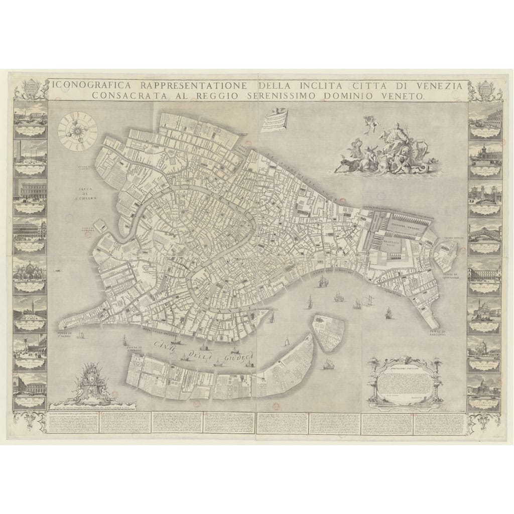


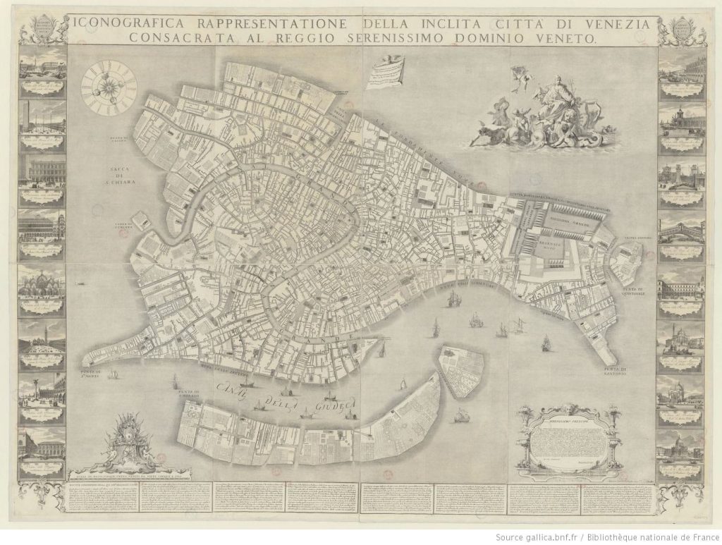
Ludovico Ughi ‘s plan from 1729
The project aims to fill a historiographical gap in studies of supply and demand in the pre-industrial age through an interdisciplinary methodology. A large number of sources contain an implicit geographical reference, but these documents are in textual form and therefore lack reference maps. Historians struggle to analyze the geographical information in these sources, and as a result, much information relating to social and economic phenomena is overlooked in studies.
To achieve the project’s objective and visualize the archival documents, it is crucial to have a map as chronologically accurate as possible to the time of the documents. The main reason Ludovico Ughi’s map is often excluded from historical cartography digitization projects is the technical difficulty of transforming it into a georeferenced map. On the other hand, while GIS allows researchers to process geographic information in innovative ways, it tends to exclude data that cannot be represented as points, lines, polygons, or pixels. The difficulty of locating information on an adequate historical map means that studies often completely neglect the spatial and geographical analysis that plays an important role in fully understanding not only the evolution of the city but also the dynamics of market behavior.


Reviews
There are no reviews yet.