| Weight | 1 kg |
|---|---|
| Numero pezzi | |
| Dimensioni puzzle | 35 cm x 50 cm |
| Dimensioni scatola | 8 cm x 8 cm x 28 cm |
| Formato | |
| Marca | |
| Difficoltà | |
| EAN | 5600709299009 |
5 motivi per acquistare i nostri puzzle d'arte


29,90€
29,90€
2 in stock
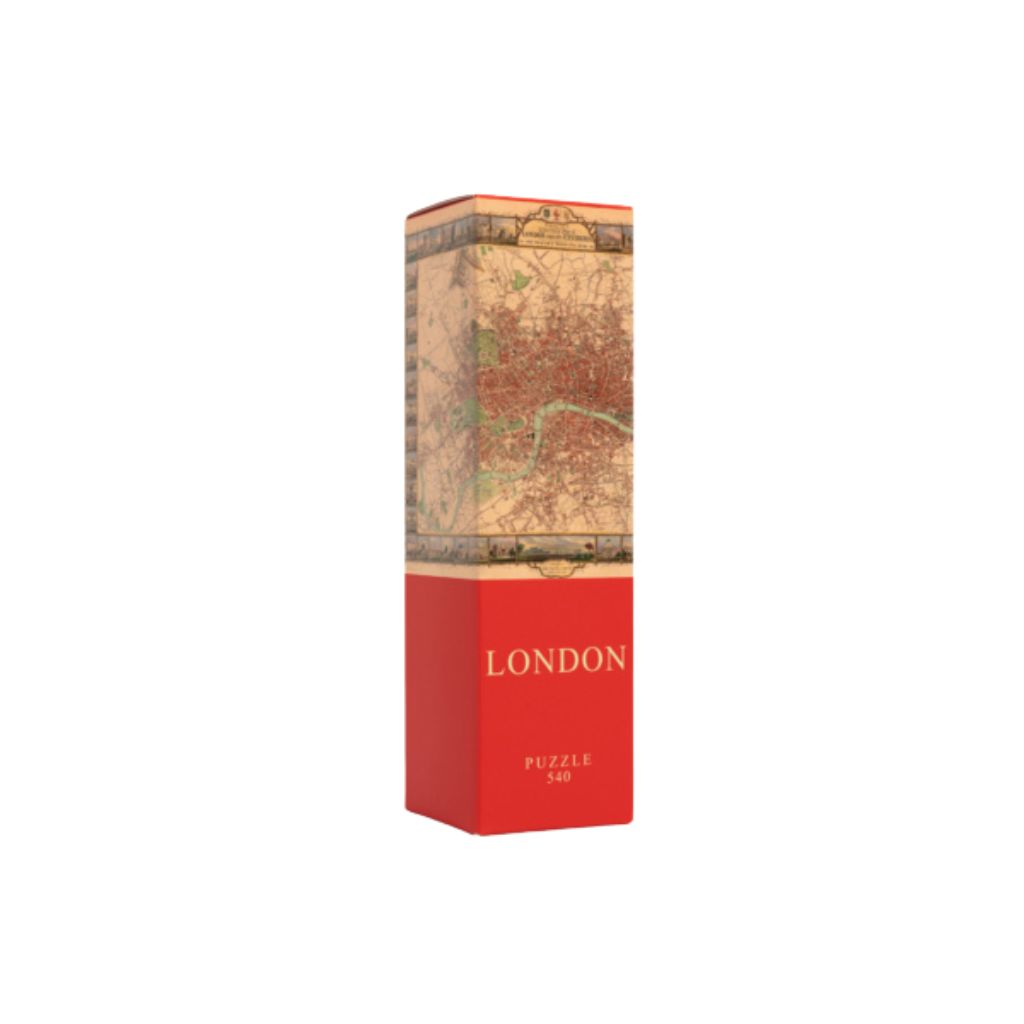
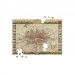
London Puzzle: An elegant 19th-century map by John Tallis and John Rapkin, combining technical detail and illustrative decoration, a tribute to the grandeur of Victorian London.
Questo puzzle è momentaneamente esaurito.
Nel frattempo, ti suggeriamo alcuni puzzle d’arte che potrebbero piacerti!


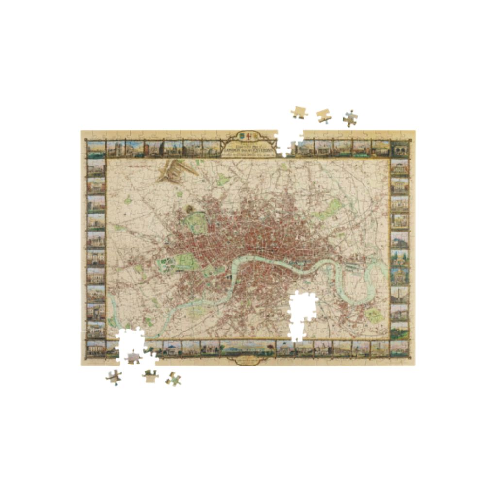
The London puzzle reproduces the splendid Illustrated Plan of London and its Environs, a highly detailed map designed by John Rapkin and published by the renowned map publisher John Tallis.
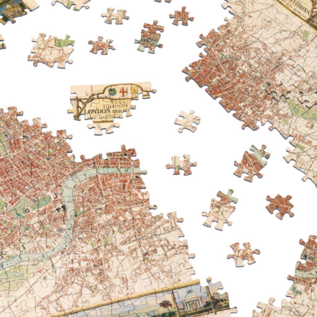
With its 540 pieces, this Architoys puzzle takes you on a journey through Victorian London, among regal palaces, bustling streets, and monumental parks. A fascinating experience for those who love graphic precision and the urban history of the British capital.
Rapkin’s map is distinguished by its refined lines and the balance between functionality and beauty. Every element, from neighborhoods to the River Thames, from cathedrals to bridges, is meticulously depicted, in a perfect balance between illustrative art and cartographic science.
Published under the supervision of John Tallis, this map is a masterpiece of engraving and printing, a symbol of mid-nineteenth-century cartography. Topographical accuracy combines with elegant vignettes framing views of the city and its most famous monuments.
By building this puzzle, you can relive the charm of Victorian London, piece by piece.
 | Number of pieces 540 |  | Brand Architoys |
 | Puzzle dimensions (cm) 35 x 50 |  | Box dimensions (cm) 8 x 8 x 28 |
Well finished box
Wonderful gift idea
Prestigious ancient map
challenge for enthusiasts
540 pieces
Standard grid
The Illustrated Plan of London and its Environs is one of the most elegant and iconic maps in the British cartographic tradition. Printed in the 19th century by John Tallis , one of the most renowned London publishers of the period, and designed by John Rapkin, it is an extraordinary representation of the metropolis at its height of imperial splendor.
This is not just a topographical map, but an illustrated work that celebrates London as the cultural and economic capital of a global empire. Through precise lines, decorative illustrations, and architectural shots, the identity of a rapidly evolving city emerges, modern yet conscious of its past.
A perfect puzzle for those who wish to explore the historical soul of London through the art of cartography.
Complimenti!
hai una vera passione per l'arte!
Visto che sei arrivato fino a qui, meriti un premio!
Ecco uno sconto del 10% per il tuo prossimo capolavoro! ✨
29,90€ Original price was: 29,90€.27,00€Current price is: 27,00€.


Reviews
There are no reviews yet.